Résumé
Carte hydrographique de l’Europe
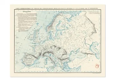
Publiée en 1842, cette carte hydrographique aussi esthétique que précise du continent européen, que son auteur le géographe français Constant Desjardins a diffusée en plusieurs langues, est un remarquable état des connaissances géographiques de son temps, synthétisées à destination des systèmes éducatifs qui se sont développés à grande vitesse dans la plupart des états d’Europe, sous l’influence du modèle napoléonien.
Hydrographic Map of Europe
Published in 1842, this hydrographic map as aesthetic as it is precise of the European continent, which its author, the French geographer Constant Desjardins, distributed in several languages, is proof of the remarkable state of geographical knowledge of his time, and which is overviewed here for the educational systems that were developing at high speed in most European states under the influence of the Napoleonic model.
Détails produit : carte vendue sous étui, Format plié : 18,3 x 33,2 cm, Format déplié : 85 x 68 cm, Une carte au recto, son histoire au verso, 9782380361704, disponible sous 2 jours.


